Las Vegas grew fast from a railroad town into a major desert metropolis, but that rapid development came with a hidden cost. The surrounding Mojave Desert landscape is shaped by flash floods and loose alluvial soils. When construction disturbs the natural ground cover, wind and water can carry away tons of sediment in a single storm. That is why we perform a thorough soil erosion analysis before any grading or foundation work. It identifies vulnerable areas and helps design effective controls. Combining this with a compaction test on site gives you a complete picture of how the soil will behave once the earth is moved.
In Las Vegas, a single summer thunderstorm can erode more soil in one hour than wind does all year.
Service characteristics in Las Vegas
Demonstration video
Critical ground factors in Las Vegas
Much of Las Vegas sits on alluvial fans and playa deposits from the Pleistocene era. These soils are loose, low in organic matter, and highly susceptible to surface erosion. The city also lies in a moderate seismic zone (IBC Seismic Design Category C), and earthquake shaking can trigger liquefaction in saturated sandy layers, accelerating erosion along slopes and channels. With average annual rainfall under 4 inches but intense summer monsoons, the risk is concentrated in short, violent events. We map these zones using historical data and field observations, then quantify the erosion rate with the Revised Universal Soil Loss Equation (RUSLE).
Our services
We break down the erosion analysis into four core services, each tailored to Las Vegas conditions.
Site Erosion Risk Assessment
Walk the site, identify vulnerable slopes, drainage patterns, and existing erosion features. We deliver a qualitative risk map (low-moderate-high) based on soil type, slope angle, and cover.
RUSLE Modeling & Sediment Yield
Quantify soil loss in tons per acre per year using the Revised Universal Soil Loss Equation, calibrated with local rainfall data from McCarran International Airport.
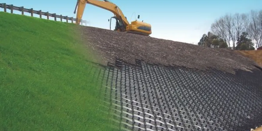
Sediment Basin & Silt Fence Design
Design temporary and permanent sediment control structures sized for the 10-year storm event, as required by Clark County permits.
Post-Construction Monitoring
Follow up after major storms to inspect erosion control measures, measure actual sediment deposition, and adjust the plan if needed.
Frequently asked questions
How much does a soil erosion analysis cost in Las Vegas?
For a typical residential or commercial lot in Las Vegas, the analysis ranges between US$920 and US$2,330, depending on site size, number of soil samples, and whether you need RUSLE modeling or just a basic risk assessment.
Do I need an erosion analysis for a small backyard project?
If your project disturbs more than 5,000 square feet of soil, Clark County requires a dust control permit and an erosion control plan. Even for smaller sites, knowing the erodibility of your soil helps you avoid costly washouts after a summer storm.
What is the RUSLE equation and why is it used here?
RUSLE calculates annual soil loss by multiplying six factors: rainfall erosivity, soil erodibility, slope length, slope steepness, cover management, and support practice. It is the standard method for US construction sites and is recognized by IBC and EPA.